|
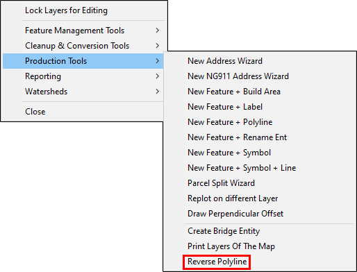
Reverse Polyline |
Some layers, reporting functions, and tools require that polylines be drawn in a consistent direction. In the case of utilities, this would be the direction of travel for the type of utility, ie, water lines. For address ranges, this would be the direction of travel from the median line. Step-by-step instructions for the Reverse Polylines tool, located on Tools Menu > Show Map Editing Tools > Advanced Tools > Production Tools, below:
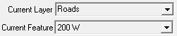
1) Lock the layer that contains the polyline to be reversed, and then set it as the Current Layer.
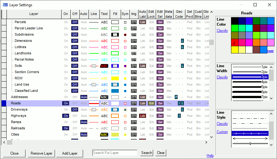
2) If the layer's line setting is already set to the arrow Line Style, skip ahead to step 3. (Before embarking on this step, it is advisable to set a function key to Recall Current Layer Settings.) If not, go to Layer Settings ![]() and select the Line column on the layer. In the configuration window on the right of the Layer Setting's window, change the Line Color to something that is easy to see (optional), adjust the Line Width to 3 pix, and set the Line Style to the arrow option.
and select the Line column on the layer. In the configuration window on the right of the Layer Setting's window, change the Line Color to something that is easy to see (optional), adjust the Line Width to 3 pix, and set the Line Style to the arrow option.
3) Go to Advanced Tools ![]() > Production Tools > Reverse Polyline.
> Production Tools > Reverse Polyline.
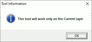
4) Click OK on the Tool Information window.
5) Position the SEL cursor ![]() over the polyline to reverse and left click.
over the polyline to reverse and left click.
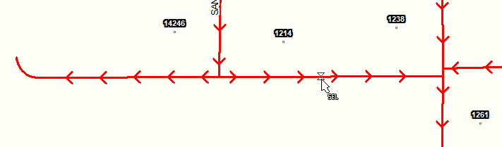
*LEFT CLICK*
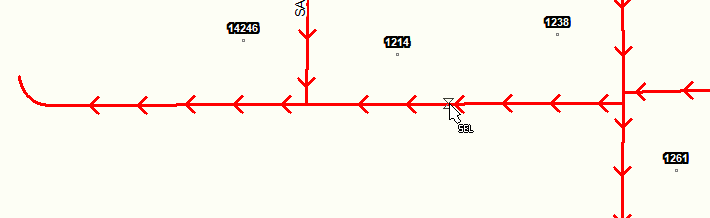
6) Right click or press ESC to get out of the tool.
Notes:
•Tool use instructions will also appear in the footer of the Think GIS window in the Instructional Bar.
|
Copyright © 2026 WTH Technology |