.png)
|
Display Layer |
This configuration is found on the Input Tab > Server Side History Report Resources. Options on this page are only available after the Geocoding Sync Group has been set up. Contact WTH for assistance in initial configuration or changes. The Display Layers refer to the layer file that should be used for drawing the background road network on maps included in reports. This is typically a road layer that covers the entire service area.
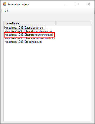
1) Select the Add button to open the Available Layers window.
2) Select the desired file, then click OK.
3) The Reverse Geocoding Layer field will now contain that file.
4) The resulting Activity Report will appear as follows:
.png)
5) Once all three parameters in the Manage Geocoding Layers module have been set then click Save on the form and click on Apply Changes and Restart Service.
|
Copyright © 2026 |
.png)