|
Redraw a Parcel |
The Parcel Split Wizard will also allow users to redraw an existing parcel. After completing the first two steps on the Parcel Split Wizard page and selecting this option, located on Tools Menu > Show Map Editing Tools > Production Tools > Parcel Split Wizard, continue as detailed below:
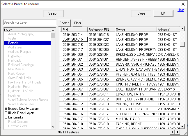
1) Find the parcel to be redrawn by using the Search function.
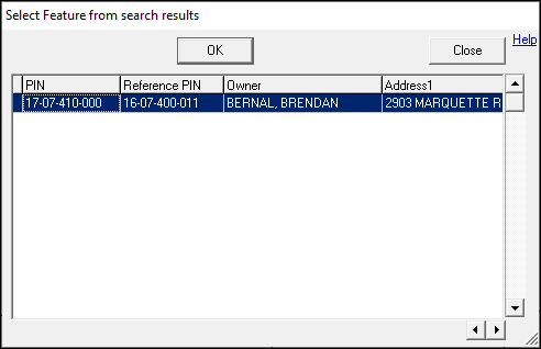
2) Once found, highlight the feature, and then click OK.
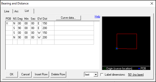
3) Place the cursor over the Point of Beginning (POB), left-click and leave the cursor on the POB, and then press D on the keyboard.
.png)
4) The Bearing and Distance tool will pop up. Fill in the calls from the deed and then click OK:
•POB: The Point of Beginning refers to the beginning of the new parcel. If the deed has a series of calls that lead to the POB, place an X in this column on the row where the new parcel actually begins. All linework drawn before the X will be removed from the final drawing.
•NS: Input the first direction of the call with either North (N) or South (S).
•Deg: Input the degrees from the call.
•Min: Input the minutes from the call.
•Sec: Input the seconds from the call.
•EW: Input the last direction of the call with either East (E) or West (W).
•Dist: Input the distance from the call.
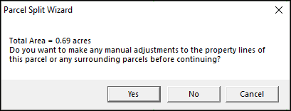
5) If any manual changes are needed to edgematch, or otherwise adjust the final parcel, click Yes and use the Move Tool to make the adjustments; otherwise, click No.
6) The newly redrawn parcel will now be on the map.
.png)
|
Copyright © 2026 WTH Technology |