|
Indiana Soil Report (Short) |
Summary
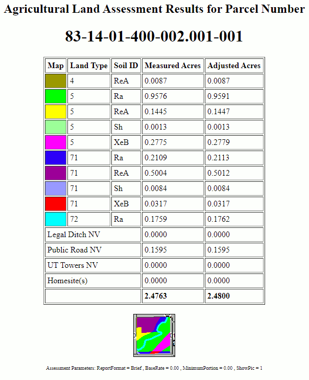
This report breaks down the selected parcel into cells of unique soil type and land use. It calculates and reports the acreage of each cell (see measured acres column). It also calculates an Adjusted acres value which is the result of uniformly scaling all acreages so that they add up exactly to the deed acreage. Some special land use types, which are assessed independent of soil type are measured and listed also. The short form is designed for users who just need to get acreage values so that they can transfer them into their assessment software where the remaining calculations will be done.
Prerequisites
This report requires that a soil layer and a land use layer be present on the map. If a predrawn land use layer does not exist, users can choose to manually designate land use on the screen. See Land Use section for required land use codes.
If the parcel layer contains a field named "Classified Forest" then Think GIS will use the exact acreage from this field in place of any type 21 land use drawn on this parcel.
|
Copyright © 2026 WTH Technology |