.png)
|
Area Search Results |
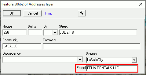
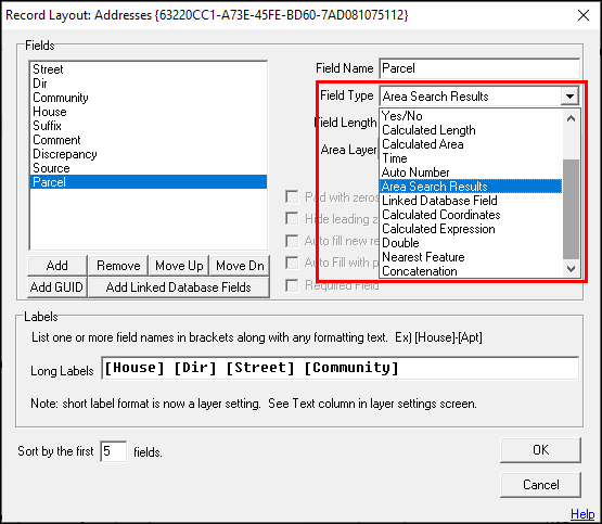
This field type displays a read only name of a bounding feature from another layer. When selected, this field type will display an additional field property to specify the name of the other layer. Each time this field's contents are displayed Think GIS determines which feature, if any, on the specified layer contains the centroid of the current feature record. It then populates this field with the long-label formatted text of the bounding feature. For example: An address layer could have an "Area Search Results" type field that automatically displays the Zoning classification that it is in based on boundaries drawn on the Zoning layer, or, as in the example below, the Address layer may be set to show the owner info from the parcel that it falls within. Note: The first 16 characters of the layer name specified must be unique to the map.
1) Enter a short, descriptive Field Name.
2) Select the Area Search Results option from the Field Type drop down menu.
3) Select the desired layer option from the Layer drop down menu.
4) Once all parameters are configured, click OK.
5) The field will now contain the feature information from the selected layer.
Notes:
•If using a viewer license or not wanting to permanently modify the layer, the Area Search Results may also be added through the Setup > Map Settings > Auto Area Search > Add Area Search option.
|
Copyright © 2026 WTH Technology |
.png)
.png)