|
Measure Distance |
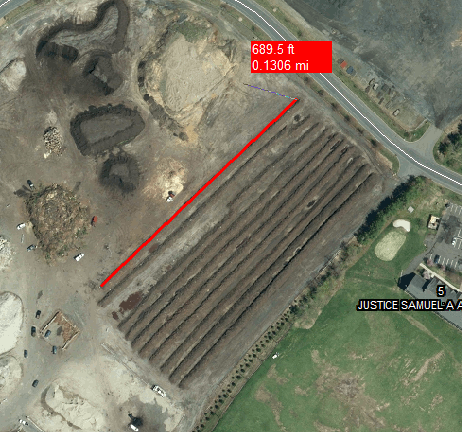
Use this tool, located on the Tools Menu, to measure the straight line distance between any two points or to measure the distance along a path.
To measure a distance:
1) Click the ![]() button or select Measure Distance from the Tools menu.
button or select Measure Distance from the Tools menu.
2) Point the mouse to the location to start measuring from and press and release the left mouse button.
3) Move the mouse to any other point and the distance will be displayed in a floating red box.
4) Continue to click on additional points and the red box will display the running distance in both feet and miles.
5) Press the right mouse button, or press Esc, when finished.
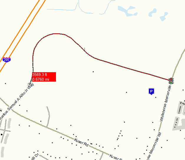
If measuring between two points on the map that are connected by a polyline, as demonstrated in the image below, then Think GIS will measure along the existing path. It will indicate this by highlighting the path. This can save hundreds of clicks in trying to trace every vertex of the polyline. For this to work, both the previous point and current point must be snapped to a vertex (indicated by a small white box). To override this option, hold down the shift key while picking the points.
Notes:
•The number in the lower left corner of the display shows the bearing and distance along the current segment of the path.
•Positioning the mouse near a line or other entity on the screen, may cause a snap box to appear (small white box or bow tie). This indicates that Think GIS has assumed that the measurement should start from this exact point on the line or entity. Since it's hard to eyeball an exact location when zoomed out very far this is usually a good thing. But to bypass these snaps simply hold down the shift key while positioning the mouse.
•To measure a discontinuous path, exclude certain segments from the running distance total. To do this, hold down the Ctrl key while drawing any segments that are not to be included in the total distance.
•Distances measured in the map will be displayed when making a print.
•The Redraw command (Alt+R) will erase measurement lines from the screen.
•Users can also retrieve the length of any Feature by double clicking it on the map display and then selecting "Display Feature Statistics" from the Feature Tools Menu.
•Users can also add a calculated field to any layer that automatically displays a Feature's length or area anytime a feature in a list or on a form is being viewed. See Layer Format.
•See also Address Calculation Tool.
|
Copyright © 2026 WTH Technology |