.png)
|
Draw a Radius from a Point |
Use this tool to generate a list of Features that are located within a certain distance from a specified point.
To List Features within a radius:
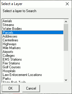
1) From the Lookup menu select List Features Within an Area - Draw a radius from a point.
2) Select a layer to search from the list that appears then click OK.
3) Position the cursor over the starting point on the map (A). This might be an address, an intersection, or any other location from which to measure.
4) Press and hold down the left mouse button at this starting point.
5) While holding the button down, start moving the mouse away from the starting point and a circle will form.
6) Move the mouse, and watch the distance readout in the lower left corner of the Think GIS screen (C).
7) Move the mouse to the desired distance (B) then release the mouse button.
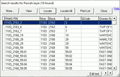
7) A search results window will appear like the one below listing all of the Features on the selected layer that are inside this circle.
See Area search menu for more options
See also Identify Area tool and Area Search Results field type.
|
Copyright © 2026 WTH Technology |
.png)