|
Address Point Order Visualizer |
This tool, located on Tools Menu > Show Map Editing Tools > Advanced Tools > Reporting, produces a report that allows users to visually spot problems with an address point layer. This report simply draws lines on the map connecting addresses that are TEXTUALLY adjacent. In other words, all addresses that have the exact same street name, direction and community name are connected in the numeric sequence of their house numbers using a certain color line. A new line and new color are used for each unique combination of street, direction, and community. This report wont catch all addressing errors but it does cause many common addressing problems to stand out like a sore thumb.
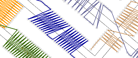
If all the addresses along a given street are spelled correctly and placed in the correct location then this report should generate a single unbroken polyline that zig zags its way down the street back and forth from one side to the other consisting of relatively short line segments. Once recognize this "normal" condition becomes easy to recognize, it will start to become obvious when spotting abnormal conditions. See examples below:
Normal Below is an example of what should be seen as described above.

Conflicting Street Name The presence of two different colored lines zig zagging down the same street indicates that some of the addresses on this street have a different street name, direction, or community.

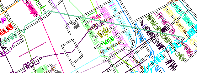
Stray Address The green line shooting diagonally across the map means that there is an address at both ends of the line with the same street name, direction, and community. Sometimes this is valid but usually its an indication of a mistyped address. As it turns out, the longer and more obvious the line is, the bigger and more important the problem is.

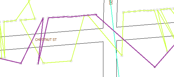
Out Of Order The yellow line makes it obvious here how poorly the addresses ordering is for this street. This could be the way it is, but this report brings attention to things like this to investigate further.

|
Copyright © 2025 WTH Technology |