|
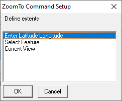
Enter Latitude Longitude |
This option from the Add Command > ZoomTo - Zoom to a rectangle list allows users to enter a specific Latitude and Longitude to zoom to in the map.
1) Select Enter Latitude Longitude, and then click OK.
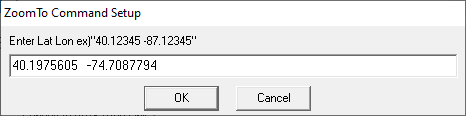
2) Enter the Latitude and Longitude in Degrees, Minutes as shown in the image below. There should be a single space between the two numbers and Longitude should include a minus "-" sign directly in front of it.
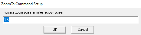
3) Enter the zoom scale. This number represents the number of miles of image visible as measured west to east across the map screen. The larger the number, the further out the user will be zoomed.
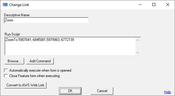
4) Fill in the Descriptive Name for the link, and then click OK.
|
Copyright © 2026 WTH Technology |