|
Birds Eye Window |
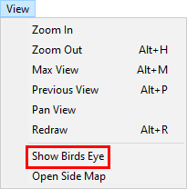
The Birds Eye window, when enabled, displays a small map insert window in the bottom right corner of the Think GIS display. This window shows a "Max View" picture of the entire map along with a white rectangle indicating the portion of the map being viewed in the main display. To Show the Birds eye window click "Show Birdseye window" on the View menu.
Using the Birds Eye to change the view
In addition to providing a big-picture perspective the Birds Eye window also provides a means of quickly panning to different areas of the map. The following mouse functionality is available:
Panning: Right click anywhere on the Birds Eye window and the view will recenter on that point.
Dynamic Panning: Hold down the right mouse button while moving the mouse around the Birds Eye window to animate the map.
Zooming: Draw a zoom rectangle anywhere on the Birds Eye window.
Max View
The Birds Eye window always displays a picture of the map taken at Max View. If a Max View has never been set, or to change it, Zoom to the desired Max View level, go to Setup > Map Settings, and then click the Set button next to the words "Max View".
|
Copyright © 2026 WTH Technology |
.png)