|
Think GIS |
What role does Think GIS play in AVL
Think GIS is the name of WTH's mapping software used to view the live vehicle locations. Unlike some single purpose AVL maps, Think GIS is a full feature GIS application designed to satisfy all mapping needs on one map display. Some of the AVL history reporting tools in AVL Administrator also make use of Think GIS to geographically show past activity. Both the Editor and Viewer versions of Think GIS are fully capable of working with AVL.
Using AVL with Web Mapping
Live AVL data may now be displayed on a secure web site making it possible to view AVL maps on phone and table devices. Contact WTH for more information.
How to setup Think GIS to view AVL
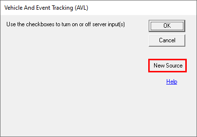
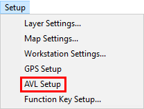
1) In Think GIS go to Setup > AVL Setup.
2) In the pop-up window, click on New Source button.
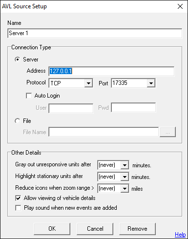
3) Configure the feed in the AVL Source Setup window.
Click on the interactive image below for more information.
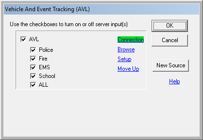
4) After all parameters are set, click OK to return to the main AVL Setup window.
Click on the interactive image below for more information.
Notes:
•See Think GIS help guide for more details.
|
Copyright © 2026 |